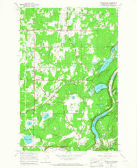
1959 Map of Tanwax Lake
USGS Topo · Published 1967About this map
The Ohop Valley defines the southeastern landscape of this Pierce County region, where the Chicago Milwaukee St Paul and Pacific railroad tracks follow the eastern shore of Ohop Lake. In the late 1950s, this area was characterized by a dense network of timber and agricultural roads named for local families, such as Carlson Road, Andrew Christiansen Road, and Hansen Road.
Find a feature on this map
54 named features on this map. Tap any name to fly to it.
Don’t see what you’re looking for? This feature index may not catch every label — zoom into the map to look around manually.
Map Details
Editions of this 1959 Tanwax Lake Map
2 editions found
Other maps of this area

1897 · Tacoma
USGS Topo · 1:125,000

1900 · Tacoma
USGS Topo · 1:125,000

1937 · Eatonville
USGS Topo · 1:125,000

1941 · Tanwax Lake
USGS Topo · 1:62,500

1941 · Tacoma South
USGS Topo · 1:62,500

1942 · Lake Tapps
USGS Topo · 1:62,500

1944 · Lake Tapps
USGS Topo · 1:62,500

1944 · Tacoma South
USGS Topo · 1:62,500

1944 · Ohop Valley
USGS Topo · 1:62,500

1949 · Ohop Valley
USGS Topo · 1:62,500