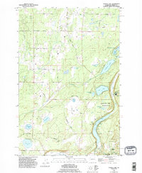
1990 Map of Tanwax Lake
USGS Topo · Published 1995About this map
Tanwax Lake and the long, linear basin of the Ohop Valley dominate this Pierce County landscape. The map reveals a dense network of glacial lakes including Silver Lake, Rapjohn Lake, and the clustered Benbow Lakes near the eastern boundary. This 1990 revision, based on surveys dating back to 1957, shows the transition from the timber and clay industries toward conservation and recreation. The Northwest Trek Wildlife Park occupies a significant portion of the terrain north of Ohop Lake, while evidence of earlier settlement remains at Clay City and Eatonville Junction. Local genealogy is anchored by the Rainier Cem and numerous named family roads like Andrew Christiansen Road and Jensen Christian Road, which trace the property lines and rural development patterns of the mid-20th century.
Find a feature on this map
49 named features on this map. Tap any name to fly to it.
Don’t see what you’re looking for? This feature index may not catch every label — zoom into the map to look around manually.
Map Details
Editions of this 1990 Tanwax Lake Map
This is the sole edition of this map. No revisions or reprints were ever made.
Other maps of this area

1897 · Tacoma
USGS Topo · 1:125,000

1900 · Tacoma
USGS Topo · 1:125,000

1937 · Eatonville
USGS Topo · 1:125,000

1941 · Tanwax Lake
USGS Topo · 1:62,500

1941 · Tacoma South
USGS Topo · 1:62,500

1942 · Lake Tapps
USGS Topo · 1:62,500

1944 · Lake Tapps
USGS Topo · 1:62,500

1944 · Tacoma South
USGS Topo · 1:62,500

1944 · Ohop Valley
USGS Topo · 1:62,500

1949 · Ohop Valley
USGS Topo · 1:62,500