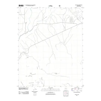
2011 Map of Taos SW
USGS Topo · Published 2011About this map
Rio Grande waters dominate the western edge of this landscape, carving through a network of high-desert canyons and drainage systems south of the Taos valley. The confluence of the Rio Pueblo de Taos and the Arroyo Hondo reveals a complex hydrological pattern, where traditional water management is visible through the presence of the Acequia Llano Quemado. The map documents a transition from residential developments on the outskirts of Taos, shown by local roads like Golf Course Dr and Vistalinda Rd, to the more industrial and natural features of the south.
Find a feature on this map
31 named features on this map. Tap any name to fly to it.
Don’t see what you’re looking for? This feature index may not catch every label — zoom into the map to look around manually.
Map Details
Editions of this 2011 Taos SW Map
This is the sole edition of this map. No revisions or reprints were ever made.
Other maps of this area
1953 · Trampas
USGS Topo · 1:24,000
1954 · Raton
USGS Topo · 1:250,000
1958 · Raton
USGS Topo · 1:250,000
1961 · Carson
USGS Topo · 1:24,000
1961 · Tres Orejas
USGS Topo · 1:24,000
1964 · Los Cordovas
USGS Topo · 1:24,000
1964 · Taos
USGS Topo · 1:24,000
1964 · Tres Ritos
USGS Topo · 1:24,000
1964 · Ranchos De Taos
USGS Topo · 1:24,000
1964 · Penasco
USGS Topo · 1:24,000