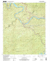
2000 Map of Tapoco
USGS Topo · Published 2001About this map
Calderwood Dam and Che Oah Dam anchor this mountain landscape, marking the engineered management of the Little Tennessee River and Che Oah River at the turn of the millennium. The settlement of Tapoco serves as a central hub near these hydroelectric structures, which includes a notable hydro-electric tunnel cutting through the terrain. The map captures a complex intersection of land management, where the Great Smoky Mountains National Park meets the Nantahala National Forest and the Joyce Kilmer-Slickrock Wilderness Area.
Find a feature on this map
103 named features on this map. Tap any name to fly to it.
Don’t see what you’re looking for? This feature index may not catch every label — zoom into the map to look around manually.
Map Details
Editions of this 2000 Tapoco Map
This is the sole edition of this map. No revisions or reprints were ever made.
Other maps of this area

1886 · Knoxville
USGS Topo · 1:125,000

1892 · Knoxville
USGS Topo · 1:125,000

1893 · Murphy
USGS Topo · 1:125,000

1894 · Knoxville
USGS Topo · 1:125,000

1895 · Loudon
USGS Topo · 1:125,000

1895 · Knoxville
USGS Topo · 1:125,000

1901 · Knoxville
USGS Topo · 1:125,000

1914 · Murphy
USGS Topo · 1:125,000

1927 · Big Junction
USGS Topo · 1:24,000

1933 · Haw Knob
USGS Topo · 1:48,000