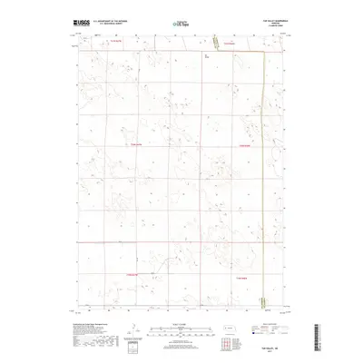
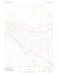
2017 Map of Tar Valley
USGS Topo · Published 2017About this map
Tar Valley defines the landscape of this region, which straddles the boundary between Morrill County and Garden County. The terrain is characterized by the intricate contour patterns typical of the Nebraska Sandhills, where drainage is sparse and the geography is shaped by depression basins and occasional water bodies. In the northeast corner of the sheet, Horse Lake sits as a primary hydrological feature in an otherwise arid expanse. The human footprint is defined by a sparse grid of rural transport, with routes like Rd 98, Rd 96, and Rd 88 providing the only structured access through the valley and surrounding sections. This 2017 study illustrates the persistent isolation of the area, where land is partitioned into large townships like t20n r47w, reflecting a ranching economy that remains dependent on the specific topography of the valley floors.
Find a feature on this map
14 named features on this map. Tap any name to fly to it.
Don’t see what you’re looking for? This feature index may not catch every label — zoom into the map to look around manually.
Map Details
Editions of this 2017 Tar Valley Map
This is the sole edition of this map. No revisions or reprints were ever made.
Other maps of this area
1896 · Browns Creek
USGS Topo · 1:125,000
1899 · Browns Creek
USGS Topo · 1:125,000
1949 · Lynn
USGS Topo · 1:62,500
1950 · Storm Lake
USGS Topo · 1:62,500

1954 · Scottsbluff
USGS Topo · 1:250,000

1958 · Scottsbluff
USGS Topo · 1:250,000
1965 · Broadwater
USGS Topo · 1:24,000
1965 · Broadwater NE
USGS Topo · 1:24,000
1971 · Richardson Lake
USGS Topo · 1:24,000
1971 · Tar Valley SW
USGS Topo · 1:24,000