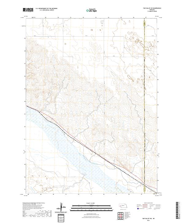
2021 Map of Tar Valley SW
USGS Topo · Published 2021About this map
The North Platte River dominates the southern portion of this landscape, its braided channels and wetlands flowing through a valley defined by early twentieth-century water management. Parallel to the river, the Lisco Canal and Belmont Canal represent the vital irrigation infrastructure that transformed this region of the Nebraska Panhandle into productive agricultural land. The map documents the stark boundary between the river valley and the rising, dissected uplands to the north, where a geometric grid of rural roads such as RD 137 and RD 86 provides access to the high plains. Along the eastern edge, the Morrill Co Garden Co boundary line marks the transition between these two Western Nebraska counties, reflecting the long-established township and range surveying system that governs the division of this prairie terrain.
Find a feature on this map
19 named features on this map. Tap any name to fly to it.
Don’t see what you’re looking for? This feature index may not catch every label — zoom into the map to look around manually.
Map Details
Editions of this 2021 Tar Valley SW Map
This is the sole edition of this map. No revisions or reprints were ever made.
Other maps of this area

1896 · Browns Creek
USGS Topo · 1:125,000

1899 · Browns Creek
USGS Topo · 1:125,000

1899 · Sidney
USGS Topo · 1:125,000

1954 · Scottsbluff
USGS Topo · 1:250,000

1958 · Scottsbluff
USGS Topo · 1:250,000

1965 · Broadwater
USGS Topo · 1:24,000

1965 · Broadwater NE
USGS Topo · 1:24,000

1971 · Richardson Lake
USGS Topo · 1:24,000

1971 · Tar Valley SW
USGS Topo · 1:24,000
1971 · Buske Ranch
USGS Topo · 1:24,000