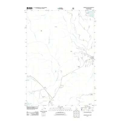
2011 Map of Targhee Pass
USGS Topo · Published 2011About this map
Targhee Pass serves as a critical geographic gateway on the Idaho-Montana border, where the headwaters of the Missouri and Snake River systems converge. In this 2011 landscape, the transition from the high-altitude Tygee Creek Basin to the shores of Henrys Lake is marked by a mix of recreational infrastructure and mountain terrain. Facilities like the Lionhead Ski Area and Lionshead RV Park and Campground illustrate the area's modern identity as a mountain retreat, while Sunset Lodge and Mountain Spring Ranch anchor the local settlement pattern. The map documents the drainage networks of Watkins Creek and Targhee Creek, alongside aviation and transit links such as Henrys Lake Airport and the Henrys Lake Dr corridor. High peaks including Bald Peak and Mount Two Top define the northern and southern horizons of this continental divide crossing.
Find a feature on this map
35 named features on this map. Tap any name to fly to it.
Don’t see what you’re looking for? This feature index may not catch every label — zoom into the map to look around manually.
Map Details
Editions of this 2011 Targhee Pass Map
This is the sole edition of this map. No revisions or reprints were ever made.
Other maps of this area

1950 · Hebgen Dam
USGS Topo · 1:62,500

1955 · Ashton
USGS Topo · 1:250,000

1958 · Ashton
USGS Topo · 1:250,000

1958 · West Yellowstone
USGS Topo · 1:62,500
1958 · Tepee Creek
USGS Topo · 1:62,500

1960 · Ashton
USGS Topo · 1:250,000

1964 · Targhee Pass
USGS Topo · 1:24,000

1964 · Targhee Peak
USGS Topo · 1:24,000

1964 · Sawtell PK
USGS Topo · 1:24,000

1964 · Big Springs
USGS Topo · 1:24,000