
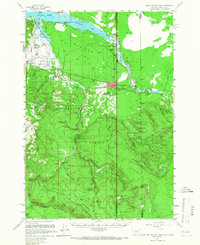
1958 Map of West Yellowstone
USGS Topo · Published 1960About this map
West Yellowstone serves as the gateway to the massive wilderness of the Yellowstone National Park, Gallatin National Forest, and Targhee National Forest shown here. This 1958 survey captures the region just before the major earthquake of 1959 changed the local landscape. The town itself is oriented around the Union Pacific rail line and the West Entrance to the park. Along the northern edge, Hebgen Lake features established sites like the Madison Arm Resort, while the backcountry is dotted with administrative and remote outposts such as the Basin Ranger Sta, Basin Cabin, and South Riverside Cabin. The landscape is a complex intersection of the Madison Valley, the Yellowstone Plateau, and the Continental Divide, which separates the waters of the South Fork Madison River from the Targhee National Forest to the south.
Find a feature on this map
54 named features on this map. Tap any name to fly to it.
Don’t see what you’re looking for? This feature index may not catch every label — zoom into the map to look around manually.
Map Details
Editions of this 1958 West Yellowstone Map
3 editions found
Other maps of this area

1885 · Gallatin
USGS Topo · 1:125,000

1885 · Gallatin
USGS Topo · 1:125,000

1886 · Shoshone
USGS Topo · 1:125,000

1888 · Shoshone
USGS Topo · 1:125,000

1895 · Shoshone
USGS Topo · 1:125,000

1901 · Shoshone
USGS Topo · 1:125,000

1901 · Gallatin
USGS Topo · 1:125,000

1908 · Gallatin
USGS Topo · 1:125,000

1908 · Shoshone
USGS Topo · 1:125,000

1911 · Shoshone
USGS Topo · 1:125,000
Featured Places
- West Yellowstone, MT
- Railroad Summer Home Area, MT
- Lonesome Hurst Summer Home Area, MT
- Romsett Summer Home Area, MT
- Lakeshore Summer Home Area, MT