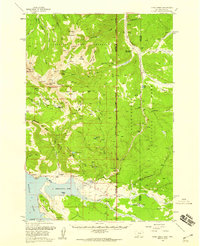
1958 Map of Tepee Creek
USGS Topo · Published 1960About this map
Yellowstone National Park and the Gallatin National Forest converge in this mid-century topographical study, documenting the landscape shortly before the transformative Hebgen Lake earthquake. The map captures a transition from high alpine ridges like Red Mountain and Monument Mountain down to the shores of the Grayling Arm of Hebgen Lake. Human activity is primarily centered on forest management and recreation, evidenced by the Cabin Creek Ranger Sta, a Patrol Cabin, and the Bacon Rind Cr Road Camp.
Find a feature on this map
54 named features on this map. Tap any name to fly to it.
Don’t see what you’re looking for? This feature index may not catch every label — zoom into the map to look around manually.
Map Details
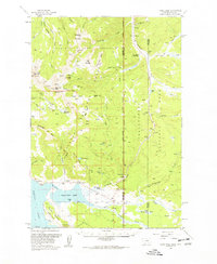
Editions of this 1958 Tepee Creek Map
2 editions found
Other maps of this area

1885 · Gallatin
USGS Topo · 1:125,000

1885 · Gallatin
USGS Topo · 1:125,000

1888 · Three Forks
USGS Topo · 1:250,000

1891 · Livingston
USGS Topo · 1:250,000

1893 · Livingston
USGS Topo · 1:250,000

1894 · Three Forks
USGS Topo · 1:250,000

1895 · Three Forks
USGS Topo · 1:250,000

1901 · Gallatin
USGS Topo · 1:125,000

1908 · Gallatin
USGS Topo · 1:125,000

1911 · Gallatin
USGS Topo · 1:125,000