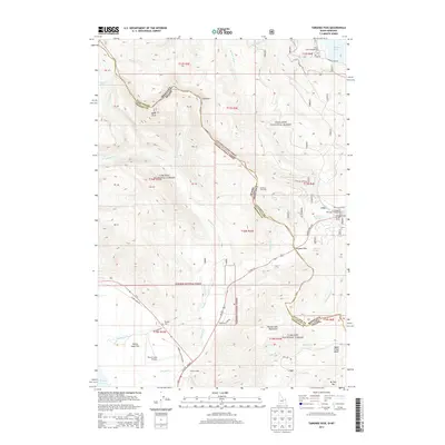
2013 Map of Targhee Pass
USGS Topo · Published 2013About this map
Targhee Pass serves as a critical geographic and administrative threshold, marking the high-altitude divide where the Montana and Idaho state line intersects the boundary between the Gallatin National Forest and Targhee National Forest. The landscape is dominated by significant peaks like Lionhead and Mt Two Top, which frame a region heavily focused on mountain recreation and seasonal residency. Evidence of this is seen in the Lionhead Ski Area, the aviation access provided by Henrys Lake Airport, and various lodgings such as Sunset Lodge. To the southwest, the waters of Henrys Lake are protected by Henrys Lake State Park, while the northeastern corner reveals a portion of Hebgen Lake. Transportation across this challenging terrain is anchored by US Hwy 20, which follows the natural corridors carved by Targhee Creek and Howard Creek. Local history is anchored at the Targhee Cem, located near the northern shore of the lake flats.
Find a feature on this map
56 named features on this map. Tap any name to fly to it.
Don’t see what you’re looking for? This feature index may not catch every label — zoom into the map to look around manually.
Map Details
Editions of this 2013 Targhee Pass Map
This is the sole edition of this map. No revisions or reprints were ever made.
Other maps of this area

1950 · Hebgen Dam
USGS Topo · 1:62,500

1955 · Ashton
USGS Topo · 1:250,000

1958 · Ashton
USGS Topo · 1:250,000

1958 · West Yellowstone
USGS Topo · 1:62,500
1958 · Tepee Creek
USGS Topo · 1:62,500

1960 · Ashton
USGS Topo · 1:250,000

1964 · Targhee Pass
USGS Topo · 1:24,000

1964 · Targhee Peak
USGS Topo · 1:24,000

1964 · Sawtell PK
USGS Topo · 1:24,000

1964 · Big Springs
USGS Topo · 1:24,000