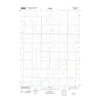
2012 Map of Tarkio SE
USGS Topo · Published 2012About this map
Little Tarkio Creek and its various tributaries, including the Long Branch and East Fork Little Tarkio Creek, carve a dendritic drainage pattern across this Atchison County landscape. The area is defined by a rigid section-line road grid, including R Ave and 300 St, which organize the agricultural territory and local transit. While largely rural, the presence of the Cleveland Airport and the Walkup Cemetery provides focal points for local history and regional navigation. At the southern edge, county thoroughfares like Co Hwy-40 and Co Hwy-47 intersect with secondary roads such as Graystone Rd, showing the modern connectivity that serves these farming communities. This USGS survey highlights the persisting spatial arrangement of Missouri's northwest corner in the early 21st century.
Find a feature on this map
27 named features on this map. Tap any name to fly to it.
Don’t see what you’re looking for? This feature index may not catch every label — zoom into the map to look around manually.
Map Details
Editions of this 2012 Tarkio SE Map
This is the sole edition of this map. No revisions or reprints were ever made.
Other maps of this area

1920 · Craig
USGS Topo · 1:62,500

1926 · Maitland
USGS Topo · 1:62,500

1936 · Fairfax
USGS Topo · 1:24,000

1939 · Tarkio
USGS Topo · 1:62,500

1939 · Skidmore
USGS Topo · 1:62,500

1940 · Tarkio
USGS Topo · 1:62,500

1941 · Tarkio
USGS Topo · 1:62,500

1941 · Skidmore
USGS Topo · 1:62,500

1942 · Skidmore
USGS Topo · 1:62,500

1955 · Nebraska City
USGS Topo · 1:250,000