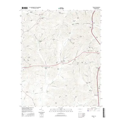
2016 Map of Tarpley
USGS Topo · Published 2016About this map
Aymett Town and the surrounding rural communities of Tarpley and Bunker Hill occupy this section of Giles County, where the landscape is defined by a dense network of creek valleys and ridges. Numerous family and community cemeteries are scattered throughout the hills, including New Providence Cem, Powell Chapel Cem, and Hopkins Cem, reflecting generations of settlement in this agricultural corridor. The drainage patterns of Pigeon Roost Cr and Leatherwood Cr have historically shaped the road layouts, as seen in the winding paths of Sumac Rd and Beech Hill Rd. The map also captures several distinct elevations such as Hurricane Ridge and Gunter Ridge, which overlook smaller hamlets like Blooming Grove and Five Points. This 2016 survey documents the enduring rural character and genealogical footprint of the region, emphasizing the importance of small church-adjacent burial grounds in the local social geography.
Find a feature on this map
158 named features on this map. Tap any name to fly to it.
Don’t see what you’re looking for? This feature index may not catch every label — zoom into the map to look around manually.
Map Details
Editions of this 2016 Tarpley Map
This is the sole edition of this map. No revisions or reprints were ever made.
Other maps of this area

1936 · Milky Way
USGS Topo · 1:24,000

1936 · Aspen Hill
USGS Topo · 1:24,000

1936 · Cornersville
USGS Topo · 1:24,000

1936 · Brick Church
USGS Topo · 1:24,000

1936 · Pulaski
USGS Topo · 1:24,000

1936 · Tarpley
USGS Topo · 1:24,000

1936 · Elkton
USGS Topo · 1:24,000

1936 · Frankewing
USGS Topo · 1:24,000

1936 · Dellrose
USGS Topo · 1:24,000

1946 · Brick Church
USGS Topo · 1:24,000