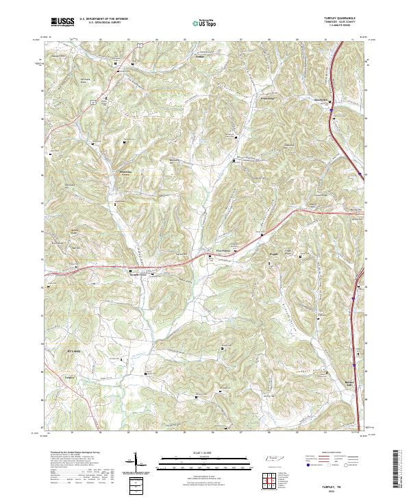
2022 Map of Tarpley
USGS Topo · Published 2022About this map
Beech Hill and the surrounding rural communities of Giles County are mapped here in the early 21st century, revealing a landscape defined by its network of hollows and ridges. This agricultural and residential area in southern Tennessee is dotted with family cemeteries and small crossroads settlements such as Blooming Grove and Aymett Town. The terrain is complex, shaped by watercourses like Leatherwood Cr and Little Bradshaw Cr which have carved out distinct features such as Worsham Hollow and Harwell Hollow.
Find a feature on this map
141 named features on this map. Tap any name to fly to it.
Don’t see what you’re looking for? This feature index may not catch every label — zoom into the map to look around manually.
Map Details
Editions of this 2022 Tarpley Map
This is the sole edition of this map. No revisions or reprints were ever made.
Other maps of this area

1936 · Milky Way
USGS Topo · 1:24,000

1936 · Aspen Hill
USGS Topo · 1:24,000

1936 · Cornersville
USGS Topo · 1:24,000

1936 · Brick Church
USGS Topo · 1:24,000

1936 · Pulaski
USGS Topo · 1:24,000

1936 · Tarpley
USGS Topo · 1:24,000

1936 · Elkton
USGS Topo · 1:24,000

1936 · Frankewing
USGS Topo · 1:24,000

1936 · Dellrose
USGS Topo · 1:24,000

1946 · Brick Church
USGS Topo · 1:24,000