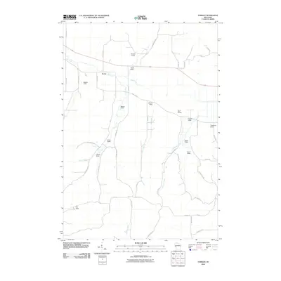
2010 Map of Tarrant
USGS Topo · Published 2010About this map
Tarrant sits at the northern edge of a landscape defined by deep valleys and winding creek beds in this West-Central Wisconsin survey. The geography is characterized by a series of coulees and named valleys, including Brunner Coulee, Prissel Valley, and Newton Valley, which indicate a long-standing pattern of family-held land and agricultural settlement. These landforms guide the drainage of Bear Creek and Tiffany Creek as they move through the township, reflecting the traditional driftless-area topography of the region.
Find a feature on this map
47 named features on this map. Tap any name to fly to it.
Don’t see what you’re looking for? This feature index may not catch every label — zoom into the map to look around manually.
Map Details
Editions of this 2010 Tarrant Map
This is the sole edition of this map. No revisions or reprints were ever made.
Other maps of this area

1929 · Durand
USGS Topo · 1:62,500

1932 · Gilmanton
USGS Topo · 1:62,500

1932 · Durand
USGS Topo · 1:62,500

1932 · Alma
USGS Topo · 1:62,500

1932 · Mondovi
USGS Topo · 1:62,500

1950 · Alma
USGS Topo · 1:62,500

1953 · Eau Claire
USGS Topo · 1:250,000

1958 · Eau Claire
USGS Topo · 1:250,000

1964 · Eau Claire
USGS Topo · 1:250,000
1972 · Meridean
USGS Topo · 1:24,000