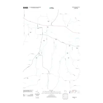
2013 Map of Tarrant
USGS Topo · Published 2013About this map
The settlement of Tarrant anchors a landscape defined by an intricate network of coulees and valleys in this 2013 survey of Pepin County. The terrain is deeply carved by watercourses, most notably Bear Cr and Tiffany Cr, which flow through family-named landmarks like Newton Valley and Brunner Coulee. These geographic features suggest a long history of agricultural settlement, where the placement of roads and farms was dictated by the drainage patterns of the Farrington Cr and Tamarack Cr systems.
Find a feature on this map
50 named features on this map. Tap any name to fly to it.
Don’t see what you’re looking for? This feature index may not catch every label — zoom into the map to look around manually.
Map Details
Editions of this 2013 Tarrant Map
This is the sole edition of this map. No revisions or reprints were ever made.
Other maps of this area

1929 · Durand
USGS Topo · 1:62,500

1932 · Gilmanton
USGS Topo · 1:62,500

1932 · Durand
USGS Topo · 1:62,500

1932 · Alma
USGS Topo · 1:62,500

1932 · Mondovi
USGS Topo · 1:62,500

1950 · Alma
USGS Topo · 1:62,500

1953 · Eau Claire
USGS Topo · 1:250,000

1958 · Eau Claire
USGS Topo · 1:250,000

1964 · Eau Claire
USGS Topo · 1:250,000
1972 · Meridean
USGS Topo · 1:24,000