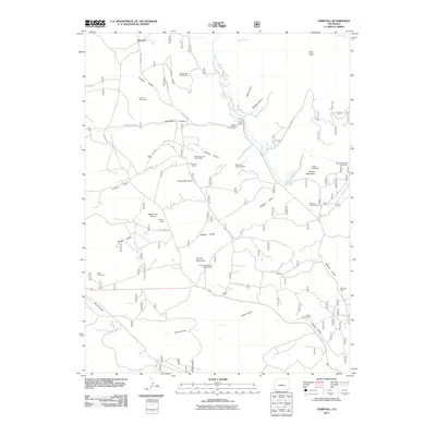
2011 Map of Tarryall
USGS Topo · Published 2011About this map
Tarryall stands as the primary namesake for this 2011 survey of the high-altitude landscape of Park County, where the transition between working ranches and intensive mineral extraction is clearly defined. The terrain is marked by a legacy of prospecting, with numerous sites such as the Wheel of Fortune Mine and the Saint Joe Tunnel dotting the drainages of Tarryall Creek. These claims, including the Redskin Claims Mine and Hill Top Claims Mine, illustrate a deep history of geological exploration among the peaks and gulches.
Find a feature on this map
48 named features on this map. Tap any name to fly to it.
Don’t see what you’re looking for? This feature index may not catch every label — zoom into the map to look around manually.
Map Details
Editions of this 2011 Tarryall Map
This is the sole edition of this map. No revisions or reprints were ever made.
Other maps of this area

1893 · Platte Canyon
USGS Topo · 1:125,000

1894 · Pikes Peak
USGS Topo · 1:125,000

1901 · Pikes Peak
USGS Topo · 1:125,000

1953 · Denver
USGS Topo · 1:250,000

1954 · Pueblo
USGS Topo · 1:250,000

1956 · Mc Curdy Mountain
USGS Topo · 1:24,000

1956 · Tarryall
USGS Topo · 1:24,000

1956 · Hackett Mountain
USGS Topo · 1:24,000

1956 · Lake George
USGS Topo · 1:24,000

1956 · Elevenmile Canyon
USGS Topo · 1:24,000