
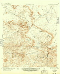
1944 Map of Tascotal Mesa
USGS Topo · Published 1944About this map
The high plateau country of the Trans-Pecos region is defined here by the massive elevations of Tascotal Mesa and Bandera Mesa. In this 1917 survey, reissued during the Second World War, the landscape is primarily organized around the sparse water sources and essential transport routes necessary for cattle ranching. The Marfa and Lajitas Road serves as the primary artery through this high desert, supplemented by the Seminole Trail and Agua Fria Trail.
Find a feature on this map
32 named features on this map. Tap any name to fly to it.
Don’t see what you’re looking for? This feature index may not catch every label — zoom into the map to look around manually.
Map Details
Editions of this 1944 Tascotal Mesa Map
2 editions found
Other maps of this area

1896 · Polvo
USGS Topo · 1:125,000

1896 · Shafter
USGS Topo · 1:125,000

1903 · Terlingua
USGS Topo · 1:125,000

1904 · Terlingua
USGS Topo · 1:125,000

1917 · Agua Fria
USGS Topo · 1:62,500

1917 · Tascotal Mesa
USGS Topo · 1:62,500

1917 · Buck Hill
USGS Topo · 1:62,500

1918 · Buck Hill
USGS Topo · 1:62,500

1918 · Jordan Gap
USGS Topo · 1:62,500

1925 · Buck Hill
USGS Topo · 1:62,500