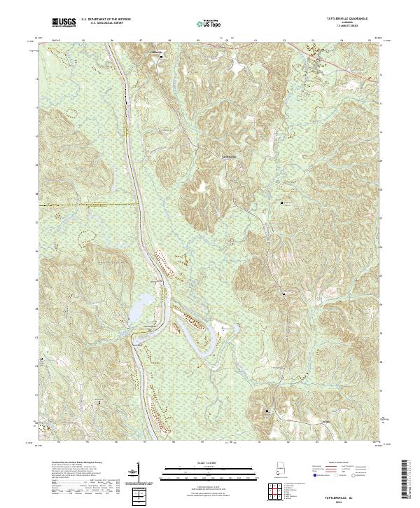
2024 Map of Tattlersville
USGS Topo · Published 2024About this map
The Tombigbee River carves a winding path along the western edge of this Clarke County landscape, defining the borders with Choctaw and Washington counties. This riverine geography is marked by distinctive features such as Hazzards Bar and Hatchitigbee Bar, while the eastern banks rise into the Hatchetigbee Hills. The settlement pattern follows the high ground and creek drainages, with Coffeeville positioned in the north and Tattlersville centrally located near the headwaters of Salitpa Creek.
Find a feature on this map
45 named features on this map. Tap any name to fly to it.
Don’t see what you’re looking for? This feature index may not catch every label — zoom into the map to look around manually.
Map Details
Editions of this 2024 Tattlersville Map
This is the sole edition of this map. No revisions or reprints were ever made.
Other maps of this area

1953 · Andalusia
USGS Topo · 1:250,000

1953 · Hattiesburg
USGS Topo · 1:250,000

1957 · Andalusia
USGS Topo · 1:250,000

1958 · Hattiesburg
USGS Topo · 1:250,000

1971 · Bigbee
USGS Topo · 1:24,000

1971 · Coffeeville
USGS Topo · 1:24,000

1971 · Bladon Springs
USGS Topo · 1:24,000

1971 · Coffeeville Lock And Dam
USGS Topo · 1:24,000

1972 · Tattlersville
USGS Topo · 1:24,000

1972 · St. Stephens
USGS Topo · 1:24,000