1944 Map of Taunton
USGS Topo · Published 1944About this map
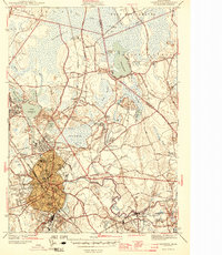
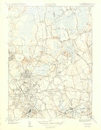
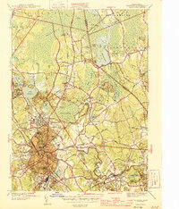
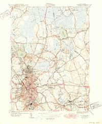
Camp Miles Standish and the Raynham Dog Track anchor the northern landscape of this wartime survey, which details a pivotal transit and industrial corridor in Bristol County. The urban core of Taunton is densely marked with civic institutions like the Taunton State Hospital, the Court House, and multiple schools including Coyle High Sch and Taunton High Sch. The New York New Haven and Hartford RR creates a critical logistics network, connecting industrial nodes at Whittenton Junction and Weir Village.
Find a feature on this map
65 named features on this map. Tap any name to fly to it.
Don’t see what you’re looking for? This feature index may not catch every label — zoom into the map to look around manually.
Map Details
Editions of this 1944 Taunton Map
4 editions found
Other maps of this area

1885 · Abington
USGS Topo · 1:62,500

1885 · Middleboro
USGS Topo · 1:62,500

1885 · Taunton
USGS Topo · 1:62,500

1886 · Dedham
USGS Topo · 1:62,500

1888 · Taunton
USGS Topo · 1:62,500

1888 · Middleboro
USGS Topo · 1:62,500

1888 · Abington
USGS Topo · 1:62,500

1893 · Abington
USGS Topo · 1:62,500

1893 · Taunton
USGS Topo · 1:62,500

1893 · Middleboro
USGS Topo · 1:62,500