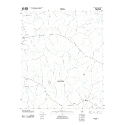
2011 Map of Taxahaw
USGS Topo · Published 2011About this map
Fourty Acre Rock stands as a prominent natural landmark in this rural South Carolina landscape, located southeast of the community of Union. The 2011 survey reveals a territory defined by a dense network of tributaries, including Flat Creek, Lick Creek, and Wildcat Creek, which feed toward the Lynches River at the northeastern corner. Settlement is concentrated at historical junctions such as Taxahaw, Fork Hill Crossroads, and the notably spelled White Bluff Corssroads. Local history and genealogy are anchored by features like the Fork Hill Cemetery and various family-named routes, including Roy Carnes Rd and Yancy Clyde Rd. The presence of the Kennington Pond Dam D-1776 near Midway reflects the water management infrastructure supporting the region's agricultural and rural residential character during this period.
Find a feature on this map
80 named features on this map. Tap any name to fly to it.
Don’t see what you’re looking for? This feature index may not catch every label — zoom into the map to look around manually.
Map Details
Editions of this 2011 Taxahaw Map
This is the sole edition of this map. No revisions or reprints were ever made.
Other maps of this area

1941 · Spartanburg
USGS Topo · 1:250,000

1953 · Spartanburg
USGS Topo · 1:250,000

1960 · Spartanburg
USGS Topo · 1:250,000

1963 · Spartanburg
USGS Topo · 1:250,000

1964 · Spartanburg
USGS Topo · 1:250,000

1967 · Mount Pisgah
USGS Topo · 1:24,000

1968 · Heath Springs
USGS Topo · 1:24,000

1968 · Jefferson
USGS Topo · 1:24,000
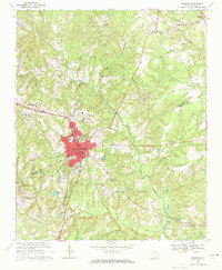
1969 · Kershaw
USGS Topo · 1:24,000

1969 · Antioch
USGS Topo · 1:24,000