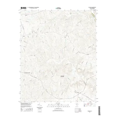
2017 Map of Taxahaw
USGS Topo · Published 2017About this map
Forty Acre Rock stands as a prominent geological feature in this portion of the South Carolina Piedmont, situated amidst a landscape defined by the upper reaches of the Lynches River system. The map reveals a network of rural settlements and community hubs such as Taxahaw and White Bluff Corssroads, which are linked by historic thoroughfares like Taxahaw Rd and Fork Hill Rd. Genealogists and local historians can find significant landmarks including the Fork Hill Cem and Fork Hill Crossroads in the western section. The drainage patterns are intricate, with Wildcat Creek, Flat Cr, and numerous named branches like Little Double Br and Sutton Br carving through the terrain. The border between Lancaster Co and Chesterfield Co follows the course of the Lynches River in the northeast corner, reflecting the relationship between natural hydrology and political boundaries.
Find a feature on this map
79 named features on this map. Tap any name to fly to it.
Don’t see what you’re looking for? This feature index may not catch every label — zoom into the map to look around manually.
Map Details
Editions of this 2017 Taxahaw Map
This is the sole edition of this map. No revisions or reprints were ever made.
Other maps of this area

1941 · Spartanburg
USGS Topo · 1:250,000

1953 · Spartanburg
USGS Topo · 1:250,000

1960 · Spartanburg
USGS Topo · 1:250,000

1963 · Spartanburg
USGS Topo · 1:250,000

1964 · Spartanburg
USGS Topo · 1:250,000

1967 · Mount Pisgah
USGS Topo · 1:24,000

1968 · Heath Springs
USGS Topo · 1:24,000

1968 · Jefferson
USGS Topo · 1:24,000
1969 · Kershaw
USGS Topo · 1:24,000

1969 · Antioch
USGS Topo · 1:24,000