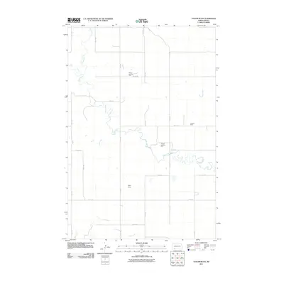
2011 Map of Taylor Butte
USGS Topo · Published 2011About this map
Taylor Butte rises above the prairie of Adams County, serving as the central landmark for this sparsely settled agricultural landscape. The region is defined by a dendritic drainage network, with Cedar Creek meandering across the central portion of the sheet while Spring Creek and Goose Creek feed the northern and central basins. This 2011 survey illustrates a modern rural infrastructure where the traditional section-line grid of local roads, such as 4th St NE and 11th Ave NE, is punctuated by private aviation markers. Small, localized airfields including Nelson Landing Strip, Erickson Field, and Fordahl Landing Strip suggest a landscape where large-scale farming or ranching operations utilize personal aircraft for transit or agricultural services. To the south, the terrain descends toward the banks of Duck Creek, maintaining the open character that has long defined this portion of the North Dakota plains.
Find a feature on this map
22 named features on this map. Tap any name to fly to it.
Don’t see what you’re looking for? This feature index may not catch every label — zoom into the map to look around manually.
Map Details
Editions of this 2011 Taylor Butte Map
This is the sole edition of this map. No revisions or reprints were ever made.
Other maps of this area

1953 · Dickinson
USGS Topo · 1:250,000

1957 · Dickinson
USGS Topo · 1:250,000

1966 · Mott SW
USGS Topo · 1:24,000

1973 · Liens Dams
USGS Topo · 1:24,000

1973 · Abbey Hill
USGS Topo · 1:24,000

1974 · Hettinger North
USGS Topo · 1:24,000

1974 · Pearl Butte NW
USGS Topo · 1:24,000

1980 · Mott
USGS Topo · 1:100,000
2011 · Taylor Butte SE
USGS Topo · 1:24,000
2011 · Abbey Hill
USGS Topo · 1:24,000