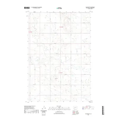
2020 Map of Taylor Butte
USGS Topo · Published 2020About this map
Taylor Butte rises above the prairie landscape of Adams County, serving as the central landmark for this North Dakota township survey. The terrain is defined by a dendritic network of drainage systems, including Ross Slough and the winding course of Cedar Creek. These watercourses create a distinct topography across the grid of section lines, reflecting the typical high plains settlement pattern where land is partitioned by cardinal avenues. The northern reaches of the quadrangle are marked by the headwaters of Spring Cr, while Duck Cr and Goose Cr drain the central and southern portions of the territory. This map documents a largely rural and agricultural region, where the infrastructure is primarily composed of a meticulous grid of numbered roads, from 10th Ave NE in the south to 18th Ave NE at the northern boundary.
Find a feature on this map
19 named features on this map. Tap any name to fly to it.
Don’t see what you’re looking for? This feature index may not catch every label — zoom into the map to look around manually.
Map Details
Editions of this 2020 Taylor Butte Map
This is the sole edition of this map. No revisions or reprints were ever made.
Other maps of this area

1953 · Dickinson
USGS Topo · 1:250,000

1957 · Dickinson
USGS Topo · 1:250,000

1966 · Mott SW
USGS Topo · 1:24,000

1973 · Liens Dams
USGS Topo · 1:24,000

1973 · Abbey Hill
USGS Topo · 1:24,000

1974 · Hettinger North
USGS Topo · 1:24,000

1974 · Pearl Butte NW
USGS Topo · 1:24,000

1980 · Mott
USGS Topo · 1:100,000
2011 · Taylor Butte SE
USGS Topo · 1:24,000
2011 · Abbey Hill
USGS Topo · 1:24,000