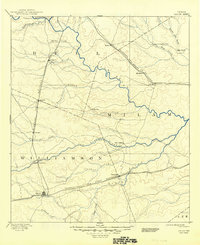
1894 Map of Taylor
USGS Topo · Published 1949About this map
Taylor and the surrounding prairie of Central Texas are documented here during the late nineteenth-century rail expansion. Three major rail lines, including the Gulf Colorado and Santa Fe Railroad and the International and Great Northern Railroad, define the settlement patterns across the borders of Bell, Milam, and Williamson counties. These corridors fostered the growth of towns like Granger, Bartlett, and Thorndale, which served as vital shipping points for the region's agricultural output.
Find a feature on this map
37 named features on this map. Tap any name to fly to it.
Don’t see what you’re looking for? This feature index may not catch every label — zoom into the map to look around manually.
Map Details
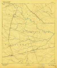
Editions of this 1894 Taylor Map
4 editions found
Other maps of this area

1885 · Taylor
USGS Topo · 1:125,000

1885 · Bastrop
USGS Topo · 1:125,000

1887 · Taylor
USGS Topo · 1:125,000

1892 · Temple
USGS Topo · 1:125,000

1893 · Georgetown
USGS Topo · 1:125,000

1893 · Bastrop
USGS Topo · 1:125,000

1894 · Gatesville
USGS Topo · 1:125,000

1894 · Taylor
USGS Topo · 1:125,000

1896 · Austin
USGS Topo · 1:125,000

1897 · Austin
USGS Topo · 1:125,000