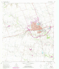
1964 Map of Taylor
USGS Topo · Published 1989About this map
The city of Taylor stands as a significant regional hub in Williamson County, defined by its crossroads of rail and road infrastructure during the mid-to-late 20th century. The Missouri Pacific Railroad cuts through the heart of the community, supporting a network of local institutions like The Johns Clinic, Taylor Hospital, and numerous educational centers including the Northside Sch and Southside Sch. The town's social fabric is evidenced by landmarks such as Hidalgo Park, the Rodeo Ground, and the Country Club. Outside the city limits, the landscape transitions into agricultural terrain drained by Mustang Creek and Battleground Creek. The inclusion of the Municipal Airport and the small settlement of Frame Switch to the west illustrates the broader connectivity of this Central Texas corridor as it appeared through the 1960s and subsequent decades.
Find a feature on this map
33 named features on this map. Tap any name to fly to it.
Don’t see what you’re looking for? This feature index may not catch every label — zoom into the map to look around manually.
Map Details
Editions of this 1964 Taylor Map
3 editions found
Other maps of this area

1885 · Taylor
USGS Topo · 1:125,000

1885 · Bastrop
USGS Topo · 1:125,000

1887 · Taylor
USGS Topo · 1:125,000

1893 · Georgetown
USGS Topo · 1:125,000

1893 · Bastrop
USGS Topo · 1:125,000

1894 · Taylor
USGS Topo · 1:125,000

1896 · Austin
USGS Topo · 1:125,000

1897 · Austin
USGS Topo · 1:125,000

1904 · Bastrop
USGS Topo · 1:125,000

1910 · Austin
USGS Topo · 1:125,000