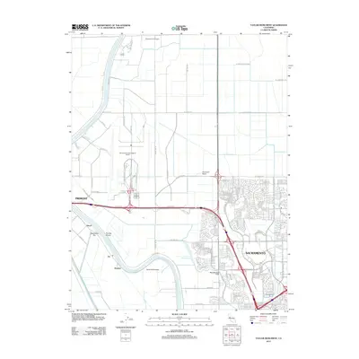
2012 Map of Taylor Monument
USGS Topo · Published 2012About this map
The Sacramento River meanders through the heart of the American Basin, defining a landscape where expansive transportation infrastructure meets fertile lowlands. To the north, the sprawling grounds of the Sacramento International Airport dominate the topography, contrasted by smaller aviation footprints like the Sopwith Farm Airport. The river's historical importance to navigation and fishing is evidenced by features such as Tenmile Shoals, Twelvemile Bar, and Fishermans Lake. Small settlements and former rail stops including Beatrice, Vin, and Kiesel sit along the riverbanks, while the namesake Taylor Monument stands near a sharp bend in the channel. The southeastern portion of the map shows the suburban expansion of Sacramento, where a dense network of residential streets and drainage canals like the West Drainage Canal manage the hydrology of this reclaimed basin.
Find a feature on this map
101 named features on this map. Tap any name to fly to it.
Don’t see what you’re looking for? This feature index may not catch every label — zoom into the map to look around manually.
Map Details
Editions of this 2012 Taylor Monument Map
This is the sole edition of this map. No revisions or reprints were ever made.
Other maps of this area

1891 · Sacramento
USGS Topo · 1:125,000

1892 · Sacramento
USGS Topo · 1:125,000

1893 · Sacramento
USGS Topo · 1:125,000

1902 · Fairoaks
USGS Topo · 1:62,500

1907 · Davisville
USGS Topo · 1:62,500

1910 · Knights Landing
USGS Topo · 1:31,680

1910 · Vernon
USGS Topo · 1:31,680

1910 · Pleasant Grove
USGS Topo · 1:31,680

1911 · Brighton
USGS Topo · 1:31,680

1911 · Arcade
USGS Topo · 1:31,680