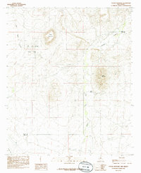
1985 Map of Taylor Mountain
USGS Topo · Published 1985About this map
City of Rocks State Park dominates the northwestern portion of this high-desert landscape, where volcanic rock formations rise above the surrounding plains. The Mimbres River valley provides a fertile corridor through the center of the sheet, supported by irrigation infrastructure including a Canal and several water wells. Near the river, the settlement of Old Town sits adjacent to a local Cem, reflecting the historical occupation of this riparian zone. The topography is defined by prominent peaks like Taylor Mountain and Table Mountain, which overlook a network of ephemeral drainages such as Cold Water Creek and Lambright Draw. Industrial activity is evident through various Quarries and a Gravel Pit, while the Grant Co Luna Co boundary line bisects the southern reaches of the quadrangle.
Find a feature on this map
14 named features on this map. Tap any name to fly to it.
Don’t see what you’re looking for? This feature index may not catch every label — zoom into the map to look around manually.
Map Details
Editions of this 1985 Taylor Mountain Map
This is the sole edition of this map. No revisions or reprints were ever made.
Other maps of this area

1899 · Deming
USGS Topo · 1:125,000

1909 · Silver City
USGS Topo · 1:125,000

1915 · Deming
USGS Topo · 1:125,000

1947 · Faywood Station
USGS Topo · 1:24,000

1948 · Hurley East
USGS Topo · 1:24,000

1949 · Hurley East
USGS Topo · 1:24,000

1949 · Faywood Station
USGS Topo · 1:24,000

1954 · Silver City
USGS Topo · 1:250,000

1955 · Las Cruces
USGS Topo · 1:250,000

1956 · Dwyer
USGS Topo · 1:62,500