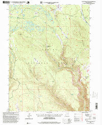
1996 Map of Taylor Mountain
USGS Topo · Published 1999About this map
Ashley National Forest dominates this 1990s topographic record, where high-elevation basins and family-named landmarks define the landscape. The northeastern portion of the map is marked by the Carter Military Trail, a significant logistical route from the 19th century, while the Red Cloud Loop provides modern access through the timbered heights. Water resources are central to this area, evidenced by the numerous gaging stations and springs such as Bodily Spring and Galloway Spring.
Find a feature on this map
45 named features on this map. Tap any name to fly to it.
Don’t see what you’re looking for? This feature index may not catch every label — zoom into the map to look around manually.
Map Details
Editions of this 1996 Taylor Mountain Map
This is the sole edition of this map. No revisions or reprints were ever made.
Other maps of this area

1885 · Ashley
USGS Topo · 1:250,000

1906 · Marsh Peak
USGS Topo · 1:125,000

1908 · Marsh Peak
USGS Topo · 1:125,000

1950 · Dyer Mountain
USGS Topo · 1:24,000

1954 · Vernal
USGS Topo · 1:250,000

1958 · Vernal
USGS Topo · 1:250,000

1960 · Vernal
USGS Topo · 1:250,000
1963 · Leidy Peak
USGS Topo · 1:24,000
1963 · East Park Reservoir
USGS Topo · 1:24,000
1963 · Elk Park
USGS Topo · 1:24,000