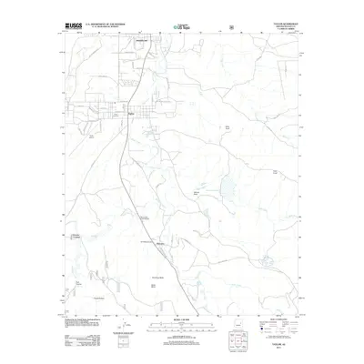
2011 Map of Taylor
USGS Topo · Published 2011About this map
Snowflake and Taylor anchor this High Country landscape in the early 21st century, where the Silver Creek valley facilitates a corridor of settlement and agriculture. The map documents the intricate water management system essential to this arid region, including The Canal, the East Taylor Ditch, and Millet Swale Reservoir. Further south, the community of Shumway sits near the base of Shumway Butte, maintaining a distinct identity separated from the northern towns by the winding path of Silver Creek. Local history is preserved at the Taylor Cemetery and Shumway Cemetery, while modern infrastructure is represented by the Taylor Airport. The topography transitions from the alluvial plains around Cottonwood Wash to more prominent landforms like Black Mesa and Taylor Knoll, illustrating the complex drainage patterns that define Navajo County geography.
Find a feature on this map
63 named features on this map. Tap any name to fly to it.
Don’t see what you’re looking for? This feature index may not catch every label — zoom into the map to look around manually.
Map Details
Editions of this 2011 Taylor Map
This is the sole edition of this map. No revisions or reprints were ever made.
Other maps of this area

1886 · St Johns
USGS Topo · 1:250,000

1886 · Holbrook
USGS Topo · 1:250,000

1892 · St Johns
USGS Topo · 1:250,000

1893 · Holbrook
USGS Topo · 1:250,000

1954 · Holbrook
USGS Topo · 1:250,000

1954 · Saint Johns
USGS Topo · 1:250,000

1957 · Holbrook
USGS Topo · 1:250,000

1957 · Saint Johns
USGS Topo · 1:250,000

1958 · Saint Johns
USGS Topo · 1:250,000

1958 · Holbrook
USGS Topo · 1:250,000