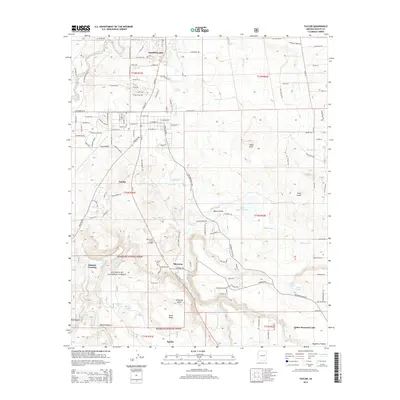
2014 Map of Taylor
USGS Topo · Published 2014About this map
Snowflake and Taylor serve as the primary hubs in this high-desert region of Navajo County, showing a detailed network of residential streets and agricultural infrastructure. The landscape is defined by the course of Silver Cr and Show-Low Creek, which support a system of irrigation including the E Taylor Ditch and The Canal. Local history is anchored by sites like Shumway, where the Shumway Cem and Shumway Butte overlook the creek valley. Further south, the map captures the transition into the Sitgreaves National Forest, where the terrain ascends toward the Mogollon Plateau. Researchers will find significant land-use data ranging from the Taylor Airport to the scattered tanks and reservoirs like Millet Swale Reservoir and Schoens Lake that are vital to this arid environment.
Find a feature on this map
162 named features on this map. Tap any name to fly to it.
Don’t see what you’re looking for? This feature index may not catch every label — zoom into the map to look around manually.
Map Details
Editions of this 2014 Taylor Map
This is the sole edition of this map. No revisions or reprints were ever made.
Other maps of this area

1886 · St Johns
USGS Topo · 1:250,000

1886 · Holbrook
USGS Topo · 1:250,000

1892 · St Johns
USGS Topo · 1:250,000

1893 · Holbrook
USGS Topo · 1:250,000

1954 · Holbrook
USGS Topo · 1:250,000

1954 · Saint Johns
USGS Topo · 1:250,000

1957 · Holbrook
USGS Topo · 1:250,000

1957 · Saint Johns
USGS Topo · 1:250,000

1958 · Saint Johns
USGS Topo · 1:250,000

1958 · Holbrook
USGS Topo · 1:250,000