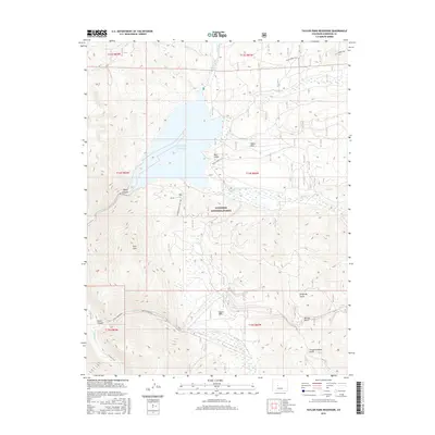
2016 Map of Taylor Park Reservoir
USGS Topo · Published 2016About this map
Taylor Park Reservoir dominates this high-altitude landscape within the Gunnison National Forest, serving as a central catchment for numerous alpine drainages. The Taylor River flows through Taylor Canyon, joined by a network of seasonal and perennial waters including Illinois Cr, Texas Cr, and Willow Cr. The map reveals a high-country basin characterized by distinct topographical features like the prominent Park Cone and several deeply cut gulches, such as Bull Gulch and Kentucky Gulch.
Find a feature on this map
29 named features on this map. Tap any name to fly to it.
Don’t see what you’re looking for? This feature index may not catch every label — zoom into the map to look around manually.
Map Details
Editions of this 2016 Taylor Park Reservoir Map
This is the sole edition of this map. No revisions or reprints were ever made.
Other maps of this area
1934 · Taylor Park
USGS Topo · 1:62,500
1937 · Taylor Park
USGS Topo · 1:62,500
1940 · Garfield
USGS Topo · 1:62,500
1941 · Pitkin
USGS Topo · 1:62,500
1945 · Pitkin
USGS Topo · 1:62,500
1945 · Garfield
USGS Topo · 1:62,500
1955 · Mount Harvard
USGS Topo · 1:62,500

1956 · Montrose
USGS Topo · 1:250,000
1959 · Montrose
USGS Topo · 1:250,000
1960 · Montrose
USGS Topo · 1:250,000