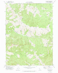
1969 Map of Taylor Peak
USGS Topo · Published 1974About this map
Bear River and the Mattole River drainage define the rugged ranching landscape of southern Humboldt County in the late 1960s. The region is characterized by named prairies and ridges, such as Sidehill Prairie and Bear River Ridge, which provided grazing land for numerous family operations including McClellan Ranch, Ambrosini Ranch, and the Lone Star Ranch. The small settlement of Hacketsville appears in the north, while a lone Cem near Moores Prairie provides a record of early residents in this remote terrain.
Find a feature on this map
45 named features on this map. Tap any name to fly to it.
Don’t see what you’re looking for? This feature index may not catch every label — zoom into the map to look around manually.
Map Details
Editions of this 1969 Taylor Peak Map
This is the sole edition of this map. No revisions or reprints were ever made.
Other maps of this area

1916 · Cape Fortunas
USGS Topo · 1:62,500

1919 · Glynn
USGS Topo · 1:62,500

1921 · Cape Mendocino
USGS Topo · 1:62,500

1943 · Ferndale
USGS Topo · 1:62,500

1944 · Fortuna
USGS Topo · 1:62,500

1949 · Eureka
USGS Topo · 1:250,000

1950 · Cape Mendocino
USGS Topo · 1:62,500

1950 · Scotia
USGS Topo · 1:62,500

1951 · Scotia
USGS Topo · 1:62,500

1951 · Cape Mendocino
USGS Topo · 1:62,500