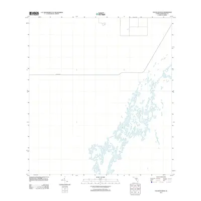
2012 Map of Taylor Slough
USGS Topo · Published 2012About this map
Taylor Slough dominates this landscape in southern Miami-Dade County, where the intricate network of the Everglades drainage system is meticulously documented. The vast wetlands are characterized by the seasonal flow patterns that define this subtropical ecosystem. Cutting across the northern reach of the survey is the Ingraham Hwy, a critical roadway that has historically provided access through these freshwater marshes and prairies. The map depicts the unique hydrology of the area, illustrating how water moves through the slough toward the coast, a pattern essential for those studying the environmental history and preservation efforts in the region during the early 21st century.
Find a feature on this map
2 named features on this map. Tap any name to fly to it.
Don’t see what you’re looking for? This feature index may not catch every label — zoom into the map to look around manually.
Map Details
Editions of this 2012 Taylor Slough Map
This is the sole edition of this map. No revisions or reprints were ever made.
Other maps of this area

1956 · Royal Palm Ranger Station
USGS Topo · 1:24,000

1956 · Royal Palm Ranger Station SE
USGS Topo · 1:24,000

1956 · Miami
USGS Topo · 1:250,000

1958 · Miami
USGS Topo · 1:250,000

1967 · Royal Palm Ranger Station SE
USGS Topo · 1:24,000

1972 · Mahogany Hammock
USGS Topo · 1:24,000

1972 · Taylor Slough
USGS Topo · 1:24,000

1972 · Madeira Bay
USGS Topo · 1:24,000

1972 · West Lake
USGS Topo · 1:24,000

1972 · Long Pine Key
USGS Topo · 1:24,000