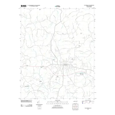
2010 Map of Taylorsville
USGS Topo · Published 2010About this map
Taylorsville serves as the central hub of this Alexander County landscape, where the foothills terrain is marked by prominent elevations like Linney Mountain and Pearson Knob. The area's hydrology is defined by the winding course of the Lower Little River, which is joined by numerous tributaries including Grassy Creek, Muddy Fork, and Stirewalt Creek. To the west, the settlement of Liledoun sits near the riverbanks, while Kilby occupies the northern reaches of the quadrangle. Local heritage is preserved in sites such as Jolly Cemetery and Mount Carmel Cemetery, reflecting the long-standing community roots in the region. Transportation and infrastructure are anchored by the Taylorsville Airport and the crossing at Bells Bridge, providing insight into the mid-century connectivity of this North Carolina piedmont area. The map also documents managed water resources like the Lower Rogers Lake Reservoir and Upper Rogers Lake near the eastern boundary.
Find a feature on this map
79 named features on this map. Tap any name to fly to it.
Don’t see what you’re looking for? This feature index may not catch every label — zoom into the map to look around manually.
Map Details
Editions of this 2010 Taylorsville Map
This is the sole edition of this map. No revisions or reprints were ever made.
Other maps of this area

1889 · Wilkesboro
USGS Topo · 1:125,000

1891 · Wilkesboro
USGS Topo · 1:125,000

1895 · Hickory
USGS Topo · 1:125,000

1953 · Charlotte
USGS Topo · 1:250,000

1953 · Winston-Salem
USGS Topo · 1:250,000

1954 · Charlotte
USGS Topo · 1:250,000

1955 · Winston-Salem
USGS Topo · 1:250,000

1960 · Charlotte
USGS Topo · 1:250,000

1962 · Winston-Salem
USGS Topo · 1:250,000

1962 · Charlotte
USGS Topo · 1:250,000