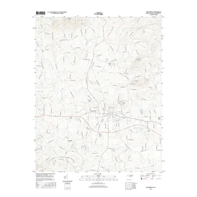
2016 Map of Taylorsville
USGS Topo · Published 2016About this map
Taylorsville serves as the focal point of this North Carolina survey, situated at the confluence of several small watercourses including Stirewalt Cr and Muddy Fork. The landscape is defined by a dense network of family-named roads and rural infrastructure, from the small aviation strips like Southern Skies Airport and Gryder-Teague Airport to the numerous local cemeteries that offer significant genealogical value. Notable burial grounds include Jolly Cem and Mount Carmel Cem, which sit alongside established congregations at Three Forks Church and Liberty Grove Church.
Find a feature on this map
185 named features on this map. Tap any name to fly to it.
Don’t see what you’re looking for? This feature index may not catch every label — zoom into the map to look around manually.
Map Details
Editions of this 2016 Taylorsville Map
This is the sole edition of this map. No revisions or reprints were ever made.
Other maps of this area

1889 · Wilkesboro
USGS Topo · 1:125,000

1891 · Wilkesboro
USGS Topo · 1:125,000

1895 · Hickory
USGS Topo · 1:125,000

1953 · Charlotte
USGS Topo · 1:250,000

1953 · Winston-Salem
USGS Topo · 1:250,000

1954 · Charlotte
USGS Topo · 1:250,000

1955 · Winston-Salem
USGS Topo · 1:250,000

1960 · Charlotte
USGS Topo · 1:250,000

1962 · Winston-Salem
USGS Topo · 1:250,000

1962 · Charlotte
USGS Topo · 1:250,000