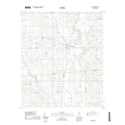
2020 Map of Taylorsville
USGS Topo · Published 2020About this map
Taylorsville serves as the central hub of this Mississippi landscape, situated at the junction of local routes like Front St and Eaton St. The town's grid is surrounded by a network of smaller communities such as Wisner to the west and Gilmore to the south. This area is defined by the convergence of several county lines, including the borders between Smith, Covington, and Jones Counties, which fragment the rural acreage into distinct survey townships.
Find a feature on this map
92 named features on this map. Tap any name to fly to it.
Don’t see what you’re looking for? This feature index may not catch every label — zoom into the map to look around manually.
Map Details
Editions of this 2020 Taylorsville Map
This is the sole edition of this map. No revisions or reprints were ever made.
Other maps of this area

1953 · Hattiesburg
USGS Topo · 1:250,000

1958 · Hattiesburg
USGS Topo · 1:250,000

1965 · Hebron
USGS Topo · 1:24,000

1965 · Hot Coffee
USGS Topo · 1:24,000

1974 · Soso
USGS Topo · 1:24,000

1974 · Collins
USGS Topo · 1:24,000
1974 · Bay Springs
USGS Topo · 1:24,000
1975 · Cohay
USGS Topo · 1:24,000

1975 · Taylorsville
USGS Topo · 1:24,000

1975 · Mize
USGS Topo · 1:24,000