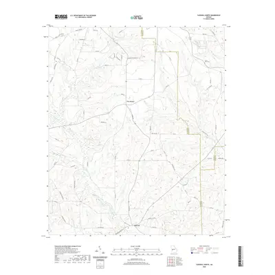
2020 Map of Tazewell North
USGS Topo · Published 2020About this map
Tazewell and Five Points serve as the primary hubs in this rural stretch of Georgia where Marion, Taylor, and Schley counties meet. The landscape is defined by an intricate network of waterways, including the winding paths of Shoal Cr, Little Shoal Cr, and Gin Creek. These streams have historically shaped the local economy and movement, evidenced by the numerous local routes such as Poll Mill Rd and Pole Hill Mill Rd that suggest a legacy of water-powered milling.
Find a feature on this map
70 named features on this map. Tap any name to fly to it.
Don’t see what you’re looking for? This feature index may not catch every label — zoom into the map to look around manually.
Map Details
Editions of this 2020 Tazewell North Map
This is the sole edition of this map. No revisions or reprints were ever made.
Other maps of this area

1907 · Talbotton
USGS Topo · 1:125,000

1950 · Geneva
USGS Topo · 1:24,000

1950 · Buena Vista NE
USGS Topo · 1:24,000

1950 · Buena Vista
USGS Topo · 1:24,000

1950 · Buena Vista
USGS Topo · 1:62,500

1950 · Talbotton
USGS Topo · 1:62,500

1955 · Buena Vista
USGS Topo · 1:24,000

1955 · Buena Vista NE
USGS Topo · 1:24,000
1955 · Geneva
USGS Topo · 1:24,000
1955 · Talbotton
USGS Topo · 1:62,500