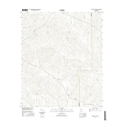
2017 Map of Tazewell South
USGS Topo · Published 2017About this map
Doyle and Putnam serve as the primary settlement points in this pocket of southwestern Georgia, where the headwaters of several significant creek systems converge. The terrain is defined by the drainage patterns of Oochee Cr, Buck Cr, and Muckalee Cr, which weave through the agricultural landscape. Local history and genealogy are anchored by established sites such as the Doyle Cem and Corinth Cem, providing a record of the area's rural families. Small water bodies like Bell Lake and Miller Lake dot the eastern side of the map near the Marion County and Schley County border. A dense network of local roads, including Harold Harris Rd and Barwick Rd, connects these small communities, reflecting a landscape that has maintained its pastoral character into the 21st century.
Find a feature on this map
53 named features on this map. Tap any name to fly to it.
Don’t see what you’re looking for? This feature index may not catch every label — zoom into the map to look around manually.
Map Details
Editions of this 2017 Tazewell South Map
This is the sole edition of this map. No revisions or reprints were ever made.
Other maps of this area

1950 · Buena Vista NE
USGS Topo · 1:24,000

1950 · Buena Vista
USGS Topo · 1:24,000

1950 · Buena Vista
USGS Topo · 1:62,500

1955 · Buena Vista
USGS Topo · 1:24,000

1955 · Buena Vista NE
USGS Topo · 1:24,000
1955 · Buena Vista
USGS Topo · 1:62,500

1955 · Phenix City
USGS Topo · 1:250,000

1957 · Phenix City
USGS Topo · 1:250,000

1958 · Phenix City
USGS Topo · 1:250,000

1971 · Rupert
USGS Topo · 1:24,000