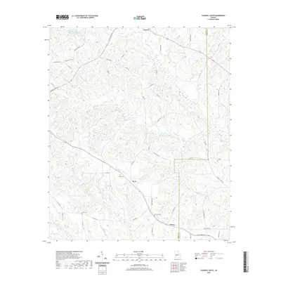
2020 Map of Tazewell South
USGS Topo · Published 2020About this map
Muckalee Cr and Oochee Creek define the drainage patterns of this Marion County landscape, where the settlements of Doyle and Putnam serve as local hubs. The terrain is marked by numerous family and community landmarks, including Doyle Cem, Corinth Cem, and New Hope Cem, which provide essential points of reference for genealogical research in this rural Georgia corridor. The map details a network of local thoroughfares such as Dr Deryl Hart Rd and Barwick Rd, illustrating the persistence of historical property boundaries and land use. Small bodies of water like Miller Lake and Cook Pond are scattered across the landscape, while the border with Schley County is established to the east, cutting through the headwaters of Buck Creek.
Find a feature on this map
56 named features on this map. Tap any name to fly to it.
Don’t see what you’re looking for? This feature index may not catch every label — zoom into the map to look around manually.
Map Details
Editions of this 2020 Tazewell South Map
This is the sole edition of this map. No revisions or reprints were ever made.
Other maps of this area

1950 · Buena Vista NE
USGS Topo · 1:24,000

1950 · Buena Vista
USGS Topo · 1:24,000

1950 · Buena Vista
USGS Topo · 1:62,500

1955 · Buena Vista
USGS Topo · 1:24,000

1955 · Buena Vista NE
USGS Topo · 1:24,000
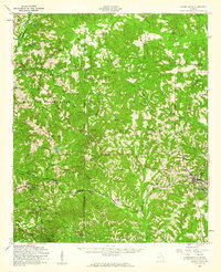
1955 · Buena Vista
USGS Topo · 1:62,500

1955 · Phenix City
USGS Topo · 1:250,000

1957 · Phenix City
USGS Topo · 1:250,000

1958 · Phenix City
USGS Topo · 1:250,000

1971 · Rupert
USGS Topo · 1:24,000