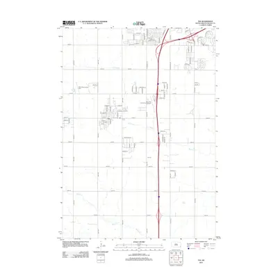
2012 Map of Tea
USGS Topo · Published 2012About this map
The growing settlement of Tea serves as the focal point of this 2012 survey, illustrating the expansion of residential and industrial corridors south of Sioux Falls. Transportation infrastructure dominates the landscape, defined by the interstate corridor and aviation hubs like the Marv Skie- Lincoln County Airport and the Chris Hofer Landing Strip. While much of the land remains divided by a grid of rural routes such as 271st ST and 85th ST, modern development is evident in the cluster of residential streets like W Charish ST and E Kevin DR. Despite this growth, the traditional rural character persists near the Tea Cem and along the natural paths of Ninemile Cr and Beaver Cr, which wind through the plains. The map captures a period of transition where industrial zones and aviation facilities increasingly border established agricultural sections.
Find a feature on this map
48 named features on this map. Tap any name to fly to it.
Don’t see what you’re looking for? This feature index may not catch every label — zoom into the map to look around manually.
Map Details
Editions of this 2012 Tea Map
This is the sole edition of this map. No revisions or reprints were ever made.
Other maps of this area

1897 · Canton
USGS Topo · 1:125,000

1900 · Canton
USGS Topo · 1:125,000

1955 · Sioux Falls
USGS Topo · 1:250,000

1958 · Sioux Falls
USGS Topo · 1:250,000

1962 · Harrisburg
USGS Topo · 1:24,000

1962 · Sioux Falls East
USGS Topo · 1:24,000

1962 · Tea
USGS Topo · 1:24,000

1962 · Hartford South
USGS Topo · 1:24,000

1962 · Lennox NW
USGS Topo · 1:24,000

1962 · Sioux Falls West
USGS Topo · 1:24,000