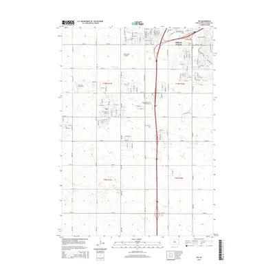
2015 Map of Tea
USGS Topo · Published 2015About this map
Sioux Falls and the growing community of Tea are the focal points of this 2015 survey, documenting the northward expansion of suburban development and industrial aviation in the region. The landscape transitions from the urbanized southern edge of the city, featuring the Colorado Technical University of Sioux Falls, into the productive agricultural terrain of the Coteau des Prairies. Transport and infrastructure are prominent, with the corridor between the Marv Skie-Lincoln County Airport and the private Chris Hofer Landing Strip indicating the importance of local aviation. Drainage patterns across the plains are defined by the meandering courses of Ninemile Cr and Beaver Cr. This map also records the rural heritage of the area, anchored by the Tea Cem south of the town center, providing a clear view of how modern street grids and interstate access have reshaped the traditional township boundaries of Lincoln and Minnehaha counties.
Find a feature on this map
105 named features on this map. Tap any name to fly to it.
Don’t see what you’re looking for? This feature index may not catch every label — zoom into the map to look around manually.
Map Details
Editions of this 2015 Tea Map
This is the sole edition of this map. No revisions or reprints were ever made.
Other maps of this area

1897 · Canton
USGS Topo · 1:125,000

1900 · Canton
USGS Topo · 1:125,000

1955 · Sioux Falls
USGS Topo · 1:250,000

1958 · Sioux Falls
USGS Topo · 1:250,000

1962 · Harrisburg
USGS Topo · 1:24,000

1962 · Sioux Falls East
USGS Topo · 1:24,000

1962 · Tea
USGS Topo · 1:24,000

1962 · Hartford South
USGS Topo · 1:24,000

1962 · Lennox NW
USGS Topo · 1:24,000

1962 · Sioux Falls West
USGS Topo · 1:24,000