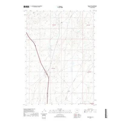
2017 Map of Teapot Rock
USGS Topo · Published 2017About this map
Teapot Rock stands as a primary landmark in this high plains landscape of Natrona County, where the drainage systems of Teapot Cr and Horse Ranch Cr carve through the arid terrain. The map illustrates a region defined by its water management and transportation history, featuring the Beaton Reservoir and the E Fork Horse Ranch Cr. The presence of the Old Salt Creek Hwy suggests the historical significance of the nearby oil fields, while the Frontage Rd follows a more modern transit corridor. To the south, the topography rises toward Twentymile Hill, accessible via the winding Twentymile Hill Rd. This survey documents the intersection of public land survey sections and natural features like Stove Gulch, providing a detailed record of the township and range divisions within the Wyoming basin.
Find a feature on this map
17 named features on this map. Tap any name to fly to it.
Don’t see what you’re looking for? This feature index may not catch every label — zoom into the map to look around manually.
Map Details
Editions of this 2017 Teapot Rock Map
This is the sole edition of this map. No revisions or reprints were ever made.
Other maps of this area

1955 · Arminto
USGS Topo · 1:250,000

1958 · Arminto
USGS Topo · 1:250,000
1959 · Edgerton
USGS Topo · 1:62,500
1959 · Ormsby Draw
USGS Topo · 1:62,500
1962 · Arminto
USGS Topo · 1:250,000
1968 · Big Gulch
USGS Topo · 1:24,000
1968 · Illco
USGS Topo · 1:24,000
1968 · Salt Creek
USGS Topo · 1:24,000
1968 · Statzer Point
USGS Topo · 1:24,000
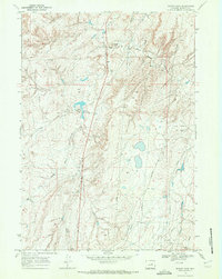
1968 · Teapot Rock
USGS Topo · 1:24,000