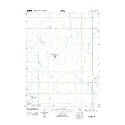
2011 Map of Tecumseh NE
USGS Topo · Published 2011About this map
Muddy Creek and Spring Creek define the drainage of this Johnson County landscape, where a sophisticated network of water management features appeared by the early 21st century. The map illustrates a series of man-made structures including Spring Creek Dam 5-A and Spring Creek Reservoir 6-A, reflecting modern conservation and agricultural engineering in the rural Midwest. Interspersed among these modern waterworks are traditional landmarks of the community's heritage. Four distinct burial grounds serve as essential anchors for local genealogy: Mount Hope Cemetery, Spring Creek Cemetery, Saint Mathews Cemetery, and Johnson Cemetery. These sites, along with the landing strip at Ensor Field, provide a clear picture of how land use evolved in this part of Nebraska, balancing long-established rural traditions with contemporary infrastructure.
Find a feature on this map
33 named features on this map. Tap any name to fly to it.
Don’t see what you’re looking for? This feature index may not catch every label — zoom into the map to look around manually.
Map Details
Editions of this 2011 Tecumseh NE Map
This is the sole edition of this map. No revisions or reprints were ever made.
Other maps of this area

1903 · Weeping Water
USGS Topo · 1:125,000

1907 · Nebraska City
USGS Topo · 1:62,500

1915 · Howe
USGS Topo · 1:62,500

1929 · Weeping Water
USGS Topo · 1:125,000

1955 · Nebraska City
USGS Topo · 1:250,000

1955 · Lincoln
USGS Topo · 1:250,000

1957 · Nebraska City
USGS Topo · 1:250,000

1957 · Lincoln
USGS Topo · 1:250,000

1958 · Lincoln
USGS Topo · 1:250,000

1958 · Nebraska City
USGS Topo · 1:250,000