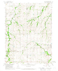
1966 Map of Tecumseh NE
USGS Topo · Published 1967About this map
The small community of Johnson sits at the eastern edge of this mid-1960s survey, marking a vital transit point on the Chicago Burlington and Quincy Railroad. This agricultural landscape is defined by the convergence of several waterways, including Spring Creek, Jones Creek, and Muddy Creek, which carve through the townships of Lincoln and Washington. The map documents a well-established rural social structure, evidenced by the distribution of schools such as Spring Creek Sch No 19 and Spring Creek Sch No 21, alongside local religious landmarks like Zion Ch.
Find a feature on this map
18 named features on this map. Tap any name to fly to it.
Don’t see what you’re looking for? This feature index may not catch every label — zoom into the map to look around manually.
Map Details
Editions of this 1966 Tecumseh NE Map
This is the sole edition of this map. No revisions or reprints were ever made.
Other maps of this area

1903 · Weeping Water
USGS Topo · 1:125,000

1907 · Nebraska City
USGS Topo · 1:62,500

1915 · Howe
USGS Topo · 1:62,500

1929 · Weeping Water
USGS Topo · 1:125,000

1955 · Nebraska City
USGS Topo · 1:250,000

1955 · Lincoln
USGS Topo · 1:250,000

1957 · Nebraska City
USGS Topo · 1:250,000

1957 · Lincoln
USGS Topo · 1:250,000

1958 · Lincoln
USGS Topo · 1:250,000

1958 · Nebraska City
USGS Topo · 1:250,000