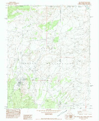
1982 Map of Teec Nos Pos
USGS Topo · Published 1983About this map
Teec Nos Pos serves as a focal point within the Navajo Indian Reservation on this 1982 provisional survey, located near the unique four-state convergence of Arizona, Utah, Colorado, and New Mexico. The settlement is centered around the Teec Nos Pos Boarding Sch, the Teec Nos Pos Chapter House, and a Rodeo Ground, reflecting its role as a community hub in the high desert landscape. The terrain is defined by the northern reaches of the Carrizo Mountains and several seasonal drainages, including Teec Nos Pos Wash and Tohache Wash, which flow toward the San Juan River to the north.
Find a feature on this map
34 named features on this map. Tap any name to fly to it.
Don’t see what you’re looking for? This feature index may not catch every label — zoom into the map to look around manually.
Map Details
Editions of this 1982 Teec Nos Pos Map
This is the sole edition of this map. No revisions or reprints were ever made.
Other maps of this area

1886 · Abajo
USGS Topo · 1:250,000

1889 · Chaco
USGS Topo · 1:250,000

1892 · Abajo
USGS Topo · 1:250,000

1892 · Chaco
USGS Topo · 1:250,000

1892 · Canyon De Chelly
USGS Topo · 1:250,000

1893 · Abajo
USGS Topo · 1:250,000

1934 · Rattlesnake
USGS Topo · 1:62,500

1937 · Rattlesnake
USGS Topo · 1:62,500

1953 · Pastora Peak SW
USGS Topo · 1:24,000

1953 · Pastora Peak NW
USGS Topo · 1:24,000
Featured Places
- Shiprock Agency
- Teec Nos Pos, Shiprock Agency
- San Juan County, NM
- Apache County, AZ
- Montezuma County, CO