
1969 Map of Tegarden
USGS Topo · Published 1971About this map
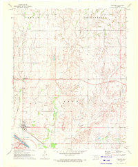
Whitehorse Creek and its many tributaries carve through this portion of Woods County, defining a landscape marked by the transition from agriculture to energy extraction. The tiny settlement of Tegarden serves as the focal point along Route 64, surrounded by a burgeoning network of industrial landmarks including numerous Gas Wells, an Oil Well, and a Drill Hole. These features illustrate the mid-century push for natural resources in the Oklahoma plains. Local history is anchored by the Whitehorse Cem and the small community of Cora, while the terrain is organized into broad sections like Whitehorse, Yellowstone, and McKinley. The map also meticulously documents field boundaries and fence lines, offering a granular look at land use just before the 1970s.
Find a feature on this map
15 named features on this map. Tap any name to fly to it.
Don’t see what you’re looking for? This feature index may not catch every label — zoom into the map to look around manually.
Map Details
Editions of this 1969 Tegarden Map
This is the sole edition of this map. No revisions or reprints were ever made.
Other maps of this area

1955 · Woodward
USGS Topo · 1:250,000

1958 · Woodward
USGS Topo · 1:250,000

1969 · Tegarden NE
USGS Topo · 1:24,000

1969 · Tegarden SE
USGS Topo · 1:24,000

1969 · Waynoka NW
USGS Topo · 1:24,000

1969 · Tegarden NW
USGS Topo · 1:24,000

1969 · Avard
USGS Topo · 1:24,000

1970 · Freedom NE
USGS Topo · 1:24,000

1970 · Fairvalley
USGS Topo · 1:24,000
1970 · Freedom
USGS Topo · 1:24,000