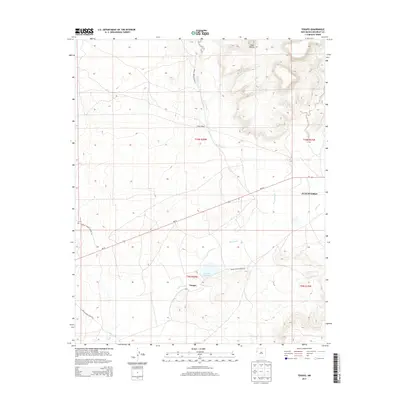
2013 Map of Tekapo
USGS Topo · Published 2013About this map
Tekapo and the surrounding high desert of McKinley County are central to this landscape, situated within the boundaries of the Zuni Pueblo reservation. The topography is dominated by the Zuñi Buttes in the northeast, where the terrain rises sharply from the valley floor. Water management in this arid environment is evidenced by the Tekapo Reservoir, which captures flow near the settlement, and the seasonal course of Bosson Wash. A complex network of Bureau of Indian Affairs roads, including Indian Service Route 11 and Indian Service Route 39, connects isolated points like Bosson Ranch to the primary artery of NM-53. The perennial Zuñi River meanders across the southern half of the quadrangle, serving as a vital geographical anchor for the region's historical and contemporary land use.
Find a feature on this map
16 named features on this map. Tap any name to fly to it.
Don’t see what you’re looking for? This feature index may not catch every label — zoom into the map to look around manually.
Map Details
Editions of this 2013 Tekapo Map
This is the sole edition of this map. No revisions or reprints were ever made.
Other maps of this area

1886 · St Johns
USGS Topo · 1:250,000

1886 · Wingate
USGS Topo · 1:250,000

1886 · Fort Defiance
USGS Topo · 1:250,000

1892 · Fort Defiance
USGS Topo · 1:250,000

1892 · St Johns
USGS Topo · 1:250,000

1892 · Wingate
USGS Topo · 1:250,000

1954 · Saint Johns
USGS Topo · 1:250,000

1954 · Gallup
USGS Topo · 1:250,000

1957 · Saint Johns
USGS Topo · 1:250,000

1958 · Gallup
USGS Topo · 1:250,000