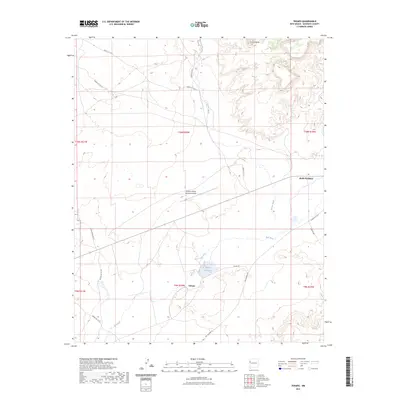
2023 Map of Tekapo
USGS Topo · Published 2023About this map
Zuni Pueblo lands dominate this high-desert landscape in McKinley County, defined by the seasonal flow of the Zuni River and Bosson Wash. The small settlement of Tekapo serves as a local focal point near the Tekapo Reservoir, illustrating the critical role of water management in this arid region. Transportation across the territory relies on a network of tribal routes, including Tekapo Rd and Ojo Caliente Rd, which connect scattered residential areas to the broader McKinley County infrastructure. The presence of the Andrew Othole Memorial Airport highlights the importance of aerial connectivity for this remote community, while landmarks like the Zuni Buttes provide distinct topographical reference points that have likely guided travelers for generations. This survey reflects the modern intersection of tribal heritage and essential infrastructure.
Find a feature on this map
23 named features on this map. Tap any name to fly to it.
Don’t see what you’re looking for? This feature index may not catch every label — zoom into the map to look around manually.
Map Details
Editions of this 2023 Tekapo Map
This is the sole edition of this map. No revisions or reprints were ever made.
Other maps of this area

1886 · St Johns
USGS Topo · 1:250,000

1886 · Wingate
USGS Topo · 1:250,000

1886 · Fort Defiance
USGS Topo · 1:250,000

1892 · Fort Defiance
USGS Topo · 1:250,000

1892 · St Johns
USGS Topo · 1:250,000

1892 · Wingate
USGS Topo · 1:250,000

1954 · Saint Johns
USGS Topo · 1:250,000

1954 · Gallup
USGS Topo · 1:250,000

1957 · Saint Johns
USGS Topo · 1:250,000

1958 · Gallup
USGS Topo · 1:250,000