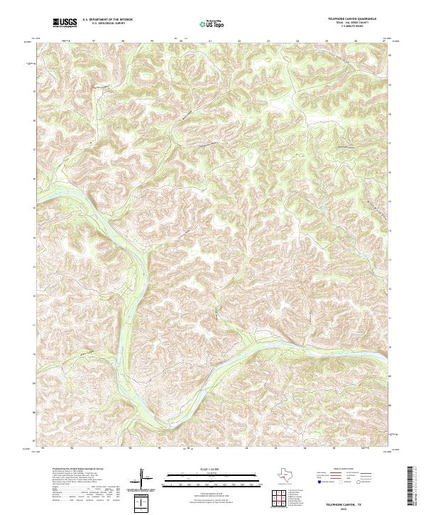
2022 Map of Telephone Canyon
USGS Topo · Published 2022About this map
Devils River dominates this southwestern Texas landscape, carving a deep, winding path through a complex network of dry drainage systems. This 2022 survey of Val Verde County illustrates a terrain defined by extensive canyon and draw formations, where water movement is seasonal and dramatic. Named features such as Huffstutler Canyon, Phillips Canyon, and Bluff Canyon feed into the river valley from the north, while Grey Canyon and Miller Canyon provide drainage from the west. The map shows the intricate topography of the Trans-Pecos region, including Telephone Canyon and Sycamore Canyon. These features represent the stark, water-carved geography typical of the Edwards Plateau's edge, highlighting the role of intermittent streams like Jack Cr and Live Oak Draw in shaping the local environment.
Find a feature on this map
14 named features on this map. Tap any name to fly to it.
Don’t see what you’re looking for? This feature index may not catch every label — zoom into the map to look around manually.
Map Details
Editions of this 2022 Telephone Canyon Map
This is the sole edition of this map. No revisions or reprints were ever made.
Other maps of this area

1944 · Dry Devil
USGS Topo · 1:62,500

1944 · Baker Crossing
USGS Topo · 1:62,500

1954 · Sonora
USGS Topo · 1:250,000

1958 · Sonora
USGS Topo · 1:250,000

1958 · Del Rio
USGS Topo · 1:250,000

1964 · Del Rio
USGS Topo · 1:250,000

1970 · Sycamore Canyon
USGS Topo · 1:24,000

1970 · Deaton Draw
USGS Topo · 1:24,000
1973 · White Draw
USGS Topo · 1:24,000
1979 · Telephone Canyon
USGS Topo · 1:24,000