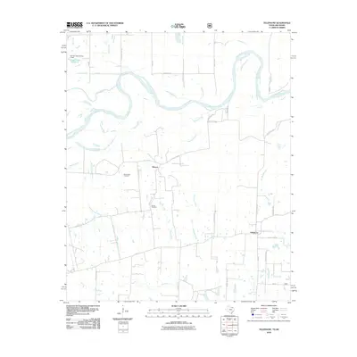
2010 Map of Telephone
USGS Topo · Published 2010About this map
The Red River snakes through the northern portion of this Fannin County landscape, defining the winding border between Texas and Oklahoma. This 2010 survey shows the rural character of the region, where small settlements like Elwood and Telephone are linked by a grid of county roads and farm-to-market routes like FM-273. The terrain is defined by its drainage towards the river, with numerous waterways including Island Bayou, Robert Springs Branch, and Elwood Creek carving through the plains.
Find a feature on this map
45 named features on this map. Tap any name to fly to it.
Don’t see what you’re looking for? This feature index may not catch every label — zoom into the map to look around manually.
Map Details
Editions of this 2010 Telephone Map
This is the sole edition of this map. No revisions or reprints were ever made.
Other maps of this area

1903 · Paris
USGS Topo · 1:125,000

1947 · Honey Grove
USGS Topo · 1:62,500

1948 · Direct
USGS Topo · 1:62,500

1949 · Direct
USGS Topo · 1:62,500

1949 · Honey Grove
USGS Topo · 1:62,500

1953 · Texarkana
USGS Topo · 1:250,000

1954 · Sherman
USGS Topo · 1:250,000

1956 · Texarkana
USGS Topo · 1:250,000

1957 · Wade
USGS Topo · 1:62,500

1958 · Bonham
USGS Topo · 1:62,500